Using GIS to Demystify Spatial Data
The DLBP UK and US teams recently attended an interesting talk on the applications of GIS for urban planners, as part of our internal program of Continued Professional Development.
Caroline Burnette, Director of Planning in the Atlanta office, led this session which addressed three key questions: what is GIS?; what GIS tools can we make use of as a company?; and how can we leverage GIS to help benefit our clients?
GIS stands for “Geographic Information System,” which creates, manages, analyzes, visualizes, and stores different types of data.
GIS has applications across a myriad of urban planning sectors, including healthcare, transport, and planning and real estate to unlock new dimensions of understanding by illustrating the spatial components of patterns.
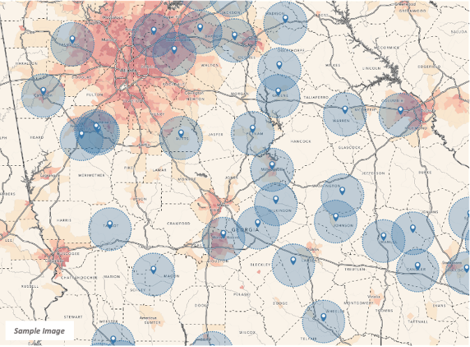
DLBP Atlanta has utilized GIS for our clients by producing story maps of strategic sites. The process involves mapping demographic data, including median household income, population density, age cohorts and average household pricing, and layering this with natural features and specific designations and zones. This information can then be used to refine a search for sites and produce dynamic story maps that summarizes a wealth of data to be shared in a dynamic format.
For one client, we produced a story map of over 200 sites and 26 markers which, by refining the search based on specific criteria, reduced the results to 8 sites of interest.
DLBP looks forward to furthering our use of ArcGIS for our clients, both in the UK and US!